
Residents can’t forget the rapid waters of the 1,000-year rain that flooded Boulder in 2013, overtopping U.S. 36 and totaling about $38 million in property damage along the creek.
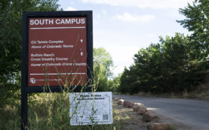
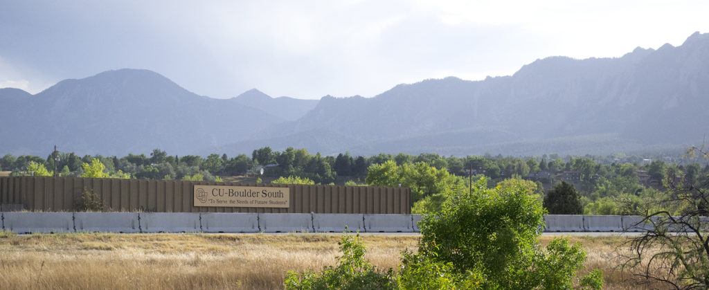
Last year, the City of Boulder announced a need for a new flood mitigation concept, and planners earlier determined that a 308-acre university-owned property known as CU South in unincorporated Boulder County was the best location for this.
While the city sees the CU land as the perfect potential for the plan that would protect about 1,100 homes downstream along South Boulder Creek in the 100-year floodplain, CU has ambitious plans to develop on this acreage for student housing and other amenities.
These conflicting agendas clashed for months; then, Boulder cut CU a deal. In return for the city using a portion of CU South for flood mitigation, the university would be permitted to annex the property into the city and fulfill a long-term plan to develop additional student housing on it.
In February, CU submitted an annexation plan for its CU South property to the city that pledged 80 acres of CU’s property to help with flood mitigation construction. The remaining 129 acres would be designated as “public” under the Boulder Valley Comprehensive Plan (BVCP) and developable.
Boulder’s response to CU’s annexation document highlighted a list of key issues: namely, that a portion of the acreage the city hopes to use for flood mitigations falls in the 129 acres of land CU wants to develop.
To compensate for this, the city proposed to purchase the land from CU or subsidize it with a 500-acre planning reserve in North Boulder. However, CU argued that the city could likely not afford the land, and there wasn’t anything comparable it could offer in exchange.
Background
CU originally purchased the land for its South Campus from Flatiron Companies in 1996 as a depleted gravel pit at the foot of the 140-square-mile South Boulder Creek drainage basin. The site was previously used for sand/gravel mining, and floodplain issues kept it from being developed.
In 2015, City Council approved the South Boulder Creek Flood Mitigation Plan, which included regional detention of flood water upstream of U.S. 36 on the CU South campus and along CDOT right of way, and two years later, an update to the Boulder Valley Comprehensive Plan ruled that the University would receive 129 acres of developable land which they could use for dorms and sports fields.
However, the need for flood mitigation amidst the development of CU’s campus lead to a series of public hearings regarding land-use.
Flood life, flood wall
A proposed Variant II plan emerged that CU officials pushed for; it would confine flood waters to the east of the 129-acre segment they want to use, whereas this plan placed a great amount of water on the land that the University hopes to develop.
Despite it receiving the most public support, with additional support from the University of Colorado and the Water Resources Advisory Board, City Council voted to move forward with the “Variant 1 500-year concept,” which allows for 30 acres of floodwater spillover on the land that is designated for public use.
The main conflict between the city and CU regarding Variant I was over a segment of approximately 30 to 36 acres that CU had planned to develop but would be right in the line of flood mitigation flow. The city’s overall problem with the Variant II plan was placement of the primarily floodwater flow restriction at U.S. 36.
While both options called for a floodwall along U.S. 36 in the CDOT right-of-way to protect the highway and Foothills Parkway — designed to prevent overtopping during a 100- or 500-year flood event — some feared that potential debris would still compromise the safety of the roadways.
At the moment, CU agreed to give 80 acres to Boulder for flood mitigation work, and to develop only 129 of the 308 acres it owns, but city staff have still been opposed to a rezoning that would let CU use a different 30- to 36-acre section on the property adjacent to the original 129 developable acres the BVCP allotted it.
Recent Developments
CDOT is currently working with the city on a floodwall concept, and the first reading of the CU annexation plan is set for early 2020. Before any mitigation efforts take place in final design, landowners need to first sign agreements.
If annexed, the CU South would come under the city’s jurisdiction like the other campuses and enjoy municipal amenities such as utility services, but the city would not own the site.
Though CU construction plans are not yet sealed, construction will likely include housing and classrooms. At the moment, CU’s master plan update won’t wrap until 2021.
Currently, the mitigation within the chosen Variant 1 concept design involves the placement of a dam extending westward from U.S. 36 to the north of CU’s planned development area.
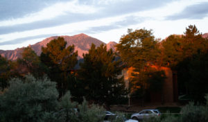
Header image: Sunrise over acres of CU property in unincorporated Boulder County land. Image: Tatyana Sharpton