Editor’s note: We’ll be updating this article as more information on fire spread gets released.
The universe or whomever you pray to granted Boulder a much-needed reprieve on Sunday with unforecasted freezing temperatures and rain in the morning. Boulder residents and those who live in its mountain towns of Gold Hill, Ward, Jamestown and Lyons are holding their breath as two wildfires that emerged over the weekend continue to threaten them.
The Cal-Wood Fire north of Lefhand Creek amid Central Gulch and Heil Valley Ranch, sparked Saturday, and Lefthand Canyon Fire, reported burning shortly before 1 p.m. on Sunday, east of Ward.
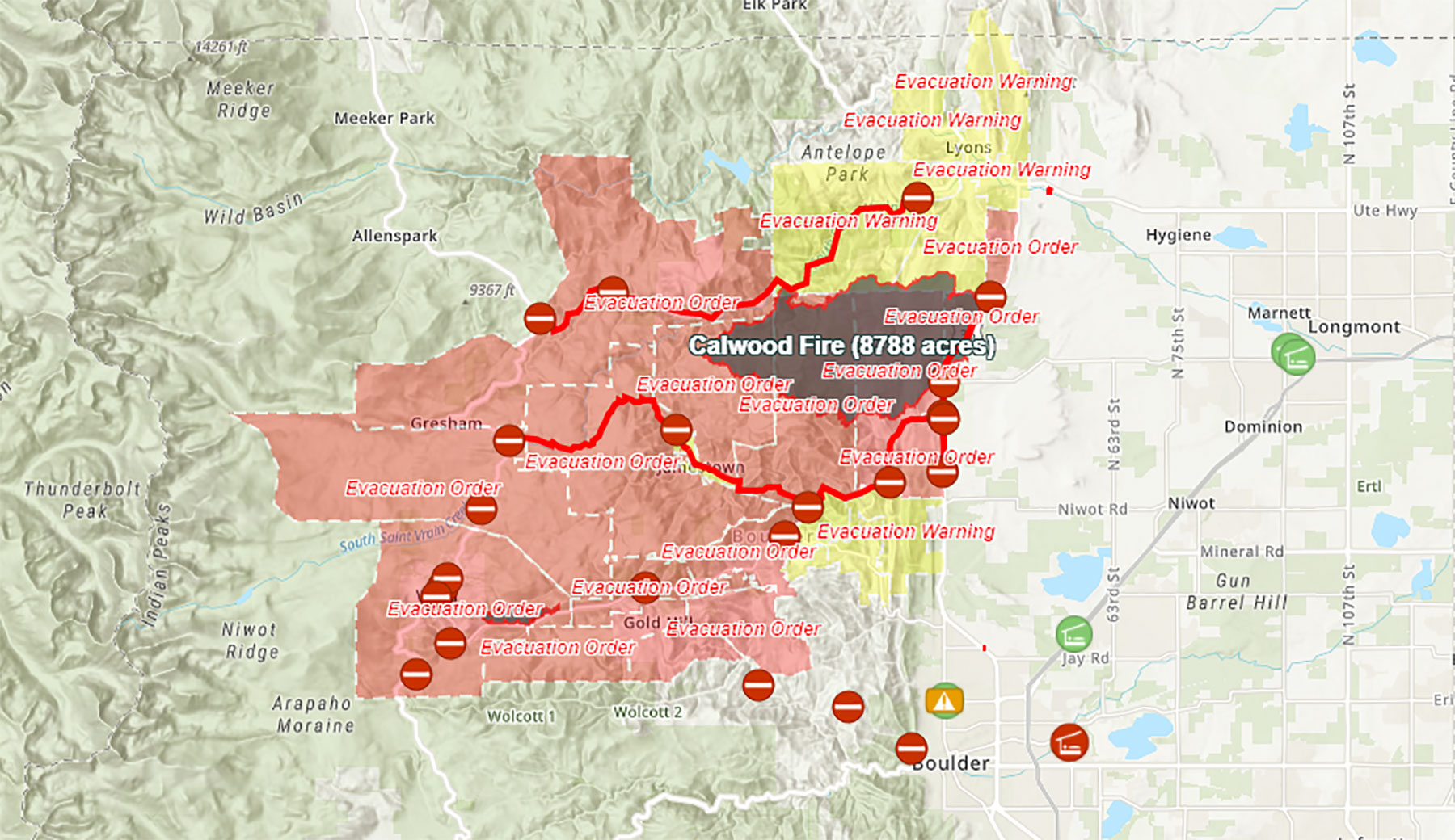
Firefighters are watching wind and temperatures closely. As of Wednesday, the Cal-Wood fire burns at nearly 10,000 acres but has reached a 24 percent containment level, according to some reports. Earlier this week, firefighters, in particular, were concerned about the fire spreading to Lyons, which remains in an evacuation warning.
[For latest, updated info, visit The Boulder Office of Emergency Management online, follow them on Twitter, and track the official real-time fire and evacuation map they manage.]
Operational update from our Operations Section Chief for October 19, 2020. Tomorrow's update will have the mention of local reference points along with the division breaks.
Posted by CalWood and Lefthand Canyon Fires on Monday, October 19, 2020
CalWood and Lefthand Fire Monday efforts shared by Incident Management Team responsible for the effort.
In a live briefing Sunday evening with Boulder’s Office of Emergency Management, Chief Mike Wagner, division 2 chief of Boulder sheriff’s office, confirmed that Cal-Wood Fire official acreage remains at 8,788, and has destroyed 26 homes, while Lefthand Canyon Fires has stayed around 312 acres.

Suppression efforts have Lefthand Canyon Fire currently contained north of Lefthand Canyon; Gold Hill area, Ward, Sunshine Canyon and a number of other residents have been evacuated. Luckily, the cloud coverage that kept firefighters from using aerial operations as planned for the Cal-Woods Fire lifted, and they were able to use aircrafts to drop water and flame retardant crafts to help suppress the Lefthand Canyon Fire quickly.
Boulder Reservoir closed to the public on Sunday evening to serve as a basepoint for those fighting the Cal-Wood and Lefthand Canyon fires after City Manager Jane Brautigam declared a local disaster emergency.
Instagram feed embed of Lefthand Canyon Fire: local photographer Dennis Haug.
Instagram feed embed: Local Boulder photographer Chet Strange.
Local firefighter tells BLDRfly this morning that the department’s concern today lays in the fire jumping over to Lyons, big factors being wind and today’s cold temperatures. Cal-Wood Fire has gone back down to eight percent contained from last night’s 15.
Boulder Office of Emergency Management releases preliminary list of the 26 structures the Cal-Wood Fire has claimed: four along Foothills Ranch Road, one along North Foothill Highway, 18 on Mountain Ridge Road and three at Heil Ranch, Chief Wagner reported last night.
An evacuation point has been set up at Boulder County’s North Broadway Complex at 3460 N. Broadway where evacuees can find information.
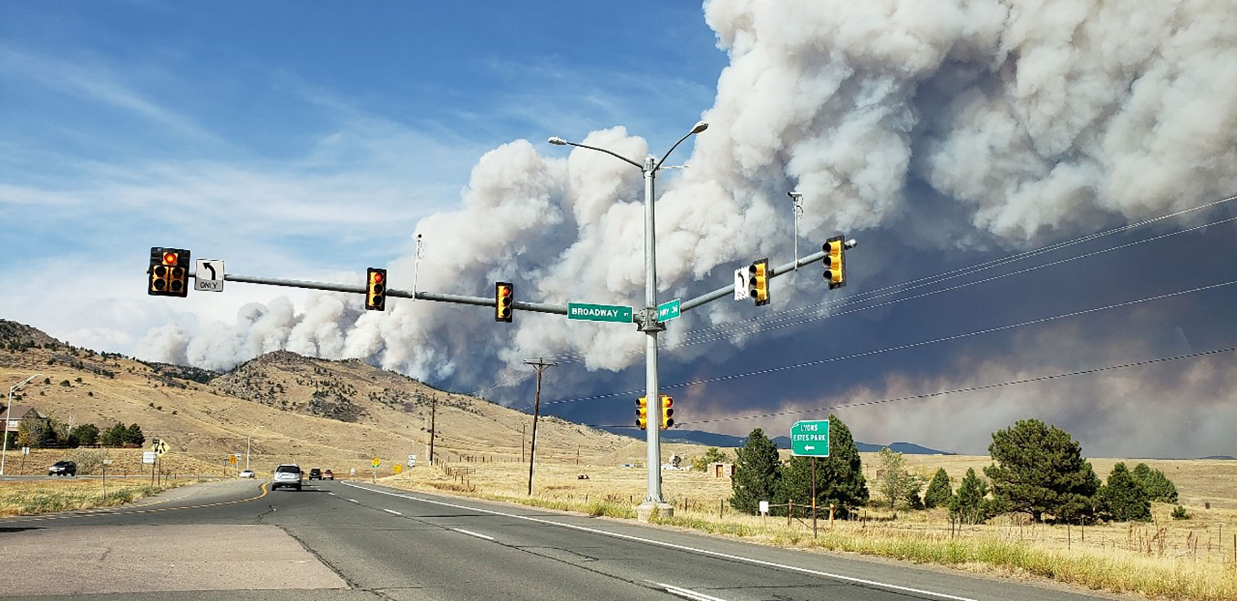
These two fires come on the heels of the recent East Troublesome Fire and earlier Cameron Peak Fire. The East Troublesome Fire began burning last Wednesday in Grand County’s Arapaho National Forest and continued to grow to up to 12,655 acres — cause of the extremely poor air quality we experienced on Friday (and the apocalyptical yellow haze) while Cameron Peak Fire up near Fort Collins has burned for over the last two months since August 13 and surpassed 200,000 acres over the weekend.
Chief Wagner has expressed that the county’s most concerning area includes the Northern ridge, “really deep, really rocky, steep terrain,” along South St. Vrain, which, mixed with the winds moving through the canyon could provide a lot of fuel availability. Investigations have begun regarding both fires. Currently, all firefighters and resources have gone to work; Chief Wagner said he couldn’t get anyone free to come with him to the briefing.
Official emergency map, updated frequently:
Road Closures
South St. Vrain between Peak to Peak Highway and Lyons, including Riverside Drive
County Road 87
Lee Hill Road is closed at Lefthand Canyon
Olde Stage Road
Heil Valley Ranch and Hall Ranch trails
Lagerman Agricultural Preserve
Pella Crossing and Anne U. White Trail
Button Rock Preserve in Longmont
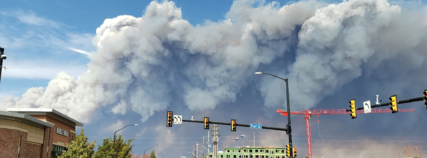
Header image: Smoke clouds billowing in Boulder. Image: Amanda June Guttierez